Darras Hall Farmhouse, Which Named It
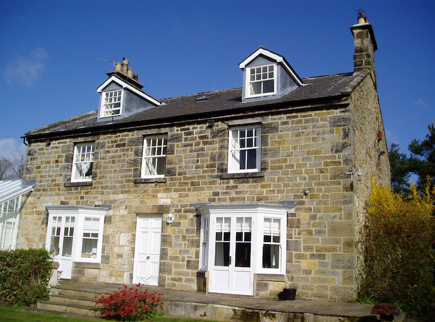
Tucked away amongst the mock-Tudor mansions at the southern edge of the Darras Hall Estate is this classic Victorian Farmhouse which gave its name to the estate which has become so well known in the North East.
Darras Hall Farmhouse — audio guide
Although the farmhouse dates to around the 1830’s, the farmstead was a medieval one. It was formerly known as Callerton Darreyns from the family of Darreyns who held it in the twelfth and thirteenth centuries. Over the years, the name Darreyns was gradually corrupted to Darras.
Like many rural communities in the North East, it was said to have been destroyed by the Scots in the fourteenth century and lay in waste for many years afterwards.
By the 17th century, the manor of Darrras Hall consisted of 6 messuages (houses with land) 2 cottages, one dove-cot, 6 gardens, 300 acres of arable land, 200 acres of meadow, 400 acres of pasture, 10 acres of wood and 500 acres of furze and heath. There was also a hall producing 20 shillings of rent a year.
There was a “Great Fire” in 1751 which presumably destroyed the old hall as in 1848 this is said to have long been in ruins.
By the 19th century, the land had been enclosed and allocated to three farms. Darras Hall farm consisted of 34 fields amounting to around 425 acres. Like almost all the farms in this area, it was tenanted; that is let to a professional farmer by the landowner who derived his income from the rents paid by his farmers. In 1872 the To Let notice stated that “The Farm is capable of much improvement, and to a tenant of skill end enterprise every encouragement will be given”.
The farm building wase arranged in a T shaped layout just to the north of the farmhouse. The southern range had a circular gin-gang attached which was a horse-powered engine for threshing corn. To the north of the outbuildings were two agricultural cottages.
It was a large farm for this district. The 1851 census lists it is employing 10 labourers working on it when only two or three were more common. The farmhouse is also consistent with this having three bays and extended to the rear. In that census, the farmer is Isaac Cowing who lived here with his wife and five children, his teenage niece and two servants.
The farm and its land was sold in 1907 to the Northern Allotments Society to develop as a residential estate but the take-up of the plots was slower than expected. The 1911 census still shows it as a working farm. The 1918 Ordnance Survey Map shows the farm and its outbuildings as unchanged.
Progress on the Darras Hall estate was slow due to the intervention of two World Wars and the inter war years which were very difficult for the North East where the economy depended on coal mining. An aerial photograph from 1947 shows the farmhouse still standing almost alone. There is a new approach road, Edge Hill and the semi-detached houses of 55 and 57 Edge Hill stand where some of the farm outbuildings and farm cottages used to be but most of the other building plots are empty. Just over ten years later the Ordnance Survey Map of 1960 shows a very different picture with most of the plots on the southern side of Edge Hill completed. By the subsequent map of 1969, there had been even more development around the old farmhouse with the building of Greenacres to the west and Deyncourt to the east (but not yet Deyncourt Close).