The Ponteland Brick and Tileworks
This was the site of the Ponteland Tileworks. There is not much documentary evidence regarding this works but we can see how it evolved by examining early maps and tracking the changes which occurred over the years.
Brick and Tileworks — audio guide
It is shown, but not labelled as a tileworks on Greenwood’s Map of Northumberland dating from 1828 and is first labelled as Ponteland Tileworks in the Ordnance Survey Map of 1859. By this stage, it must have been in existence for some time as there are multiple trenches from which the clay was extracted indicated at the site. The works themselves are a long building with a circular gin-gang attached. Gin-gangs were horse powered engines where horses would be driven around a drive shaft to power machinery before steam power became commonplace. They were generally used on farms to power threshing machines but could be used to power any machinery which could be attached to the driveshaft.
There is a trade directory of 1855 which lists Michael Clipson as brick and tile manufacturer, Ponteland Tile Works, West Houses. He was already listed as living here in the 1851 census where he was described as Drain tile maker master employing two boys. Today we associate tiles with either roofing tiles or floor or wall tiles but in Northumberland in the early and mid 19th century, the tiles which were being produced here were drainage tiles used in agriculture. Before widescale land drainage, much of the land in this part of Northumberland was only suitable grazing, being too waterlogged to grow crops. The laying of drains lined with ceramic tiles massively improved the productivity of the land, and was something of an agricultural revolution which accompanied the better known industrial one.
Michael Clipson operated here until at least the 1880’s as he still appears as the tile maker here in the census of 1881. In that year, there is another Tilemaker in Ponteland. He was William Bowring. He possibly was related to Michael as they were both born in the same village in Lincolnshire but he was twelve years younger than Michael. He looks to have taken over the works as it is just he and his family who are listed as living here in the subsequent census.
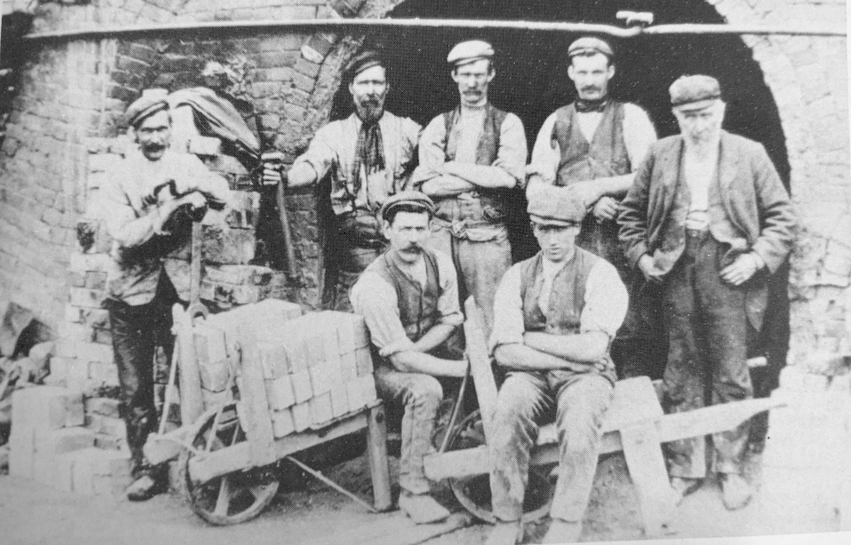
By 1911, William Bowring had taken over West Farm in the centre of the village. His son John Bowring was now the manager of the Brick and Tile Works. The 1913 Ordnance Survey Map shows substantial changes in the works since the previous map of 1895. A photograph dating from around this time show a largel kiln and that the works now look to be focusing on brick production. There are three small rows of cottages shown next to the road, by the works. However the expansion must have been too much for the works as the 1913 map also labels them as “disused”.
Half of the site is captured on an aerial photograph taken in 1947 which show the former clay pits as flooded. It is difficult to be sure, but it looks like the buildings had been removed at that stage. The next map which shows the area dates to 1960. This shows a refuse heap next to the flooded area. The refuse was presumably used to infill the pond as now the area shows no trace of the tile and brickworks.